This 2008 photo shows the southbound Delaware Expressway (I-95) approaching Center City Philadelphia. Dominating the skyline is Comcast Tower, which was completed in 2008 and stands 975 feet tall, 30 feet more than One Liberty Place (1987). One Liberty Place was the first to tower over the the 491-foot-tall City Hall, breaking a long-standing "gentlemen's agreement." (Photo by Jim K. Georges.)
THE DELAWARE RIVER PARKWAY: In 1932, the Regional Planning Federation (the predecessor agency to the Delaware Valley Regional Planning Commission) proposed a parkway system around the Philadelphia area similar to that constructed by Robert Moses. Like the Moses parkways in New York, the four-lane parkways were to feature controlled access, stone-arch bridges, timber lightposts and natural vegetation.
Most of the Delaware River waterfront in Pennsylvania had been occupied for industrial uses, and therefore unsuitable for construction of a scenic parkway. However, the regional plan proposed a parkway from Pennypack Creek in Northeast Philadelphia north to Neshaminy Creek in Croydon, Bucks County, where the riverfront was not developed.
PENNSYLVANIA'S LINK IN THE EAST COAST HIGHWAY: The Delaware Expressway was envisioned as an express link between Northeast Philadelphia, Center City and the Port of Philadelphia. Designed to link to points south as a converted Industrial Highway, and to points north via the Trenton Freeway, the Delaware Expressway was to be part of a network of "inter-regional highways connecting industrial and consumer centers" that would "provide necessary links in the internal circulation system of the city."
Beginning in 1937, engineers from the Philadelphia City Planning Commission proposed an elevated express industrial highway above Delaware Avenue through Center City Philadelphia. The design of the "Delaware Skyway" was to be similar to that of the West Side Highway in Manhattan. However, because it was found that the supporting columns would interfere with port operations, the idea was abandoned.
In 1945, engineers from the Pennsylvania Highway Department revisited the Delaware Expressway proposal as part of the proposed Interstate highway network. Two years later, both the Federal Bureau of Public Roads (BPR) and the Philadelphia City Planning Commission approved the route of the expressway.
The Philadelphia City Planning Commission stated the purpose of the Delaware Expressway as follows:
The great industrial area that runs from the Trenton area south to the Wilmington area is clustered largely along the banks of the Delaware River. The critical need of the area is a north-south express highway, running close to the Delaware River, which will link together this great industrial complex.
Merely listing the various sites that are tied together by the Delaware Expressway makes self-evident the tremendous advantages of the proposed highway. It connects with the U.S. Steel plant at Morrisville; with the Levittown, Fairless Hills and other rapidly expanding residential areas of lower Bucks County; and with the Pennsylvania Turnpike, which in turn will link through a new bridge with the New Jersey Turnpike, thus providing rapid access from Philadelphia into northern New Jersey and New York.
The Delaware Expressway will provide quick access into the downtown Philadelphia area from the populous Northeast; connect all the industrial plants along the Delaware River; connect through interchanges with the Tacony-Palmyra, Philadelphia-Camden (Benjamin Franklin) and Philadelphia-Gloucester (Walt Whitman) bridges; connect with Port of Philadelphia with the whole area; provide rapid access to Philadelphia International Airport from the entire region; and provide a rapid highway from New York into the Wilmington and Baltimore-Washington areas.
The Delaware Expressway was to be one of the costliest roads ever constructed, with costs running to $17 million per mile in Center City, and averaging more than $7 million per mile throughout the entire length of the route. Completion of the $180 million expressway originally was scheduled for 1960.
This 1968 photo shows construction of the elevated Delaware Expressway (I-95) just north of Center City Philadelphia. (Photo by Delaware Valley Regional Planning Commission.)
SHOULD IT BE A TOLL ROAD? Early in the planning stages, the route of the Delaware Expressway was considered as a toll road proposal. In the early 1950's, the Pennsylvania Turnpike Commission recommended a 750-mile network of toll superhighways crisscrossing the state. The Delaware Expressway route was shown on Turnpike Commission maps as the "Philadelphia Loop Extension" north of the present-day Mid-County Expressway / "Blue Route" (I-476), and the "Chester Extension" south of the present-day Mid-County Expressway.
In 1955, the Bureau of Municipal Research and the engineering firm Madigan-Hyland presented separate reports before the Philadelphia City Planning Commission, the Pennsylvania Department of Highways and the Pennsylvania Turnpike Commission. Both reports offered data on constructing the six-lane expressway as either a freeway facility or a toll turnpike facility (traffic volumes apply to the entire 25-mile length between the Schuylkill Expressway / I-76 and the Pennsylvania Turnpike-Delaware River Extension / I-276) as follows:
FREEWAY TRAFFIC ESTIMATES: 185,000 vehicles by 1960; 287,000 by 1980 TURNPIKE TRAFFIC ESTIMATES: 89,000 vehicles by 1960; 141,000 by 1980
The Bureau of Municipal Research, in conjunction with the Pennsylvania Economy League, came out in favor of constructing the Delaware Expressway as a toll road, with a variable toll scheme to regulate congestion during peak flow hours. The Bureau's reasoning was as follows:
The Delaware Expressway should be a great industrial and commercial highway, with primary emphasis upon its contribution to the basic economy of the city and region.
An effective beginning must be made toward mass regulation of motor vehicle traffic.
The sum total of available and foreseeable highway funds is inadequate to the total need.
The toll road, with its guarantee of maintenance of the express character of the expressway, offers an excellent low-cost method by which the city may meet the insistent demands for rapid transit to the Northeast.
A toll expressway will be completed with greater dispatch than would a free road.
In contrast, the Magidan-Hyland report came out against the use of toll revenue financing as follows:
Though the volume of traffic is very large, it is not sufficient to provide adequate revenues for revenue financing of the project, with net revenue as the only security. In order to increase the financial feasibility of the project, sponsorship guarantees or assumption of operating expenses by some public agency, or a combination of such measures, will be necessary.
Later in 1955, the Federal Bureau of Public Roads (BPR) added the entire 51 miles of the Delaware Expressway to its preliminary Interstate highway network. One year later, President Eisenhower authorized the construction of the Interstate highway system into law. With its promise of 90 percent Federal financing - state and local governments were to pay the remaining costs - the new Federal-aid highway law made the toll alternative null and void. Soon thereafter, the route was designated I-95.
LEFT: This 1978 photo shows construction of the Delaware Expressway, looking north through the Penn's Landing tunnel. RIGHT: This 1984 photo shows construction of the final section of the Delaware Expressway at Penrose Avenue in Southwest Philadelphia. (Photos by Scott Kozel.)
AN OVERVIEW OF THE ROUTE: As a project of the Interstate era, the Delaware Expressway was constructed to Interstate standards. Depending on the area, I-95 through Pennsylvania was constructed with four to eight traffic lanes. Nevertheless, 12-foot-wide lanes, 10-foot-wide shoulders, and standard-length acceleration and deceleration lanes apply throughout much of I-95 through Pennsylvania. Originally built with a guardrail-separated median, the highway now has a concrete ("Jersey") median barrier.
Through Delaware County, I-95 was constructed both as a depressed roadway and a roadway built at street level. In the city of Chester, the route was constructed along the right-of-way of the Baltimore and Ohio Railroad. Continuing north from EXIT 7 (I-476 / Mid-County Expressway / "Blue Route") interchange toward Philadelphia International Airport, the expressway gains an additional lane in each direction.
Moving into the city of Philadelphia, I-95 loses the additional lane in each direction at EXIT 13 (PA 291-Penrose Avenue), where traffic headed for the westbound Schuylkill Expressway (I-76) exits. After passing by Fort Miffin, I-95 crosses the Schuylkill River over the six-lane, dual-deck Girard Point Bridge. Flanked on both sides by one-mile-long viaducts, the steel-arch span provides 135 feet of vertical clearance.
In South Philadelphia, the Delaware Expressway returns to eight lanes at EXIT 17 (PA 611-Broad Street) near the Sports Complex and former Philadelphia Naval Base. The elevated I-95 passes through the Port of Philadelphia and under the Walt Whitman Bridge before continuing north along South Front Street.
Approaching Center City Philadelphia, the eight-lane Delaware Expressway gradually shifts from an elevated roadway to a below-grade, cut-and-cover roadway. Near Penn's Landing, there is a 1,700-foot-long, 12-lane tunnel that provides has two four-lane tubes in each direction for the mainline I-95, and two two-lane tubes for entrance and exit ramps.
The eight-lane Delaware Expressway shifts gradually back into an elevated roadway just past the Benjamin Franklin Bridge at EXIT 22 (I-676 / US 30 / Vine Street Expressway). For nearly a mile north of this interchange, the SEPTA Market-Frankford line emerges from underground in the median of the expressway. (The Spring Garden Station is in the I-95 median.) This rapid transit route leaves the I-95 median as an elevated line.
Five miles to the north, just after the Betsy Ross Bridge, the above-grade Delaware Expressway parallels the Amtrak-SEPTA (R7 Regional Rail) right-of-way into Bucks County. Before leaving Philadelphia, the grade-separated I-95 narrows to six lanes. Continuing north, I-95 intersects the Woodhaven Road Expressway (PA 63) in Bensalem before narrowing to four lanes at EXIT 40 (PA 413) in Bristol. The four-lane I-95 thence continues north along the revised alignment to the Scudders Falls Bridge into New Jersey.
These 2000 photos show the northbound Delaware Expressway (I-95) at the dual-deck Girard Point Bridge (left photo) and approaching the Walt Whitman Bridge (right photo). (Photos by Jim K. Georges.)
DECIDING UPON AN ALIGNMENT IN BUCKS COUNTY: To the north of Philadelphia, Pennsylvania initially sought to route I-95 across the Delaware River along the Trenton Toll Bridge, then north through Trenton along the Trenton Freeway (current US 1). The original alignment of I-95 in Bucks County was to continue from the current EXIT 40 (PA 413) in Bristol, and proceed north along the US 13 corridor to the vicinity of Morrisville. It was to have interchanges at PA 413, the Pennsylvania Turnpike-Delaware River Extension (I-276) in Bristol, and Levittown Parkway in Levittown.
However, New Jersey officials opposed this routing on the basis of the physical and capacity constraints on the four-lane bridge and freeway. The two states jointly investigated three alternative river crossings: Scudder Falls (west of Trenton), existing Trenton Toll Bridge-Trenton Freeway (through downtown), and Biles Island (east of Trenton). After further study, the two states approved the Scudder Falls alignment in 1960. The new western alignment was approved by the BPR in 1964. Ultimately, the rerouting of I-95 would prove to be a primary reason why a direct interchange between the Delaware Expressway and the Pennsylvania Turnpike-Philadelphia Extension was never constructed.
North of Levittown, part of the original alignment of I-95 was constructed in the mid-1950's as the US 13 Expressway. Between Bristol and Levittown, the pre-1964 alignment of I-95 was never constructed. (A proposal to revive this unbuilt original alignment as an extension of the US 13 Expressway foundered for years amid controversy. The proposed US 13, which would have required the acquisition of a section of Silver Lake County Park, was abandoned by the late 1970's.)
EARLY CONSTRUCTION PROGRESS: In 1959, the Delaware River Joint Toll Bridge Commission (DRJTBC) constructed a new toll-supported bridge between Lower Makefield Township, Pennsylvania and Ewing Township, New Jersey. The 1,740-foot-long, ten-span bridge, which carries four lanes of traffic across the Delaware River, was completed in 1959. However, the bridge did not open until two years later, when the DRJTBC constructed temporary approaches on both sides of the span.
Back in Pennsylvania, construction commenced on I-95 in 1959 along two non-continuous sections: one through Delaware County, and the other in Northeast Philadelphia and lower Bucks County. By 1962, the following sections of the Delaware Expressway were opened to traffic:
from the Pennsylvania-Delaware state line north to US 13 (near the current EXIT 7 / I-476) in Eddystone Township
from EXIT 30 (PA 73 / Cottman Avenue) in Northeast Philadelphia north to EXIT 40 (PA 413) in Bristol Township
Through the remainder of the 1960's, work crews continued to make progress on the Delaware Expressway through Northeast Philadelphia and Bucks County, By 1969, a continuous, non-stop route from Trenton (Scudder Falls Bridge) south to Center City Philadelphia (EXIT 23 / Girard Avenue) had opened to traffic. At the temporary southern terminus of I-95, the expressway ended on an elevated embankment, from which there was a temporary roadway transition to the local street network.
In 1975, the Delaware County section of I-95 was extended north from EXIT 7 to EXIT 10 (PA 291 / Governor Printz Boulevard) in Essington. One year later, an isolated stretch of the Delaware Expressway in South Philadelphia also opened between EXIT 15 (Enterprise Avenue) near Fort Miffin and EXIT 19 (I-76 / Schuylkill Expressway). This section of I-95 included the construction of the dual-deck Girard Point Bridge.
In the early 1970's, PennDOT submitted this plan for the "cover" over the Delaware Expressway (I-95) through Penn's Landing and Society Hill, on the bottom of the map. Funding difficulties prompted PennDOT to scale down the length of the cover. Note the unbuilt Crosstown Expressway (I-695) on the left side of the map, which was canceled in 1974. (Drawing from Pennsylvania Department of Transportation archives.)
CONTROVERSY IN CENTER CITY: Further north, one of the most controversial battles over the Interstate highway system took place along the Center City stretch of the Delaware Expressway. The 1955 Madigan-Hyland report called for a six-lane elevated highway through the area; this plan was revised for an eight-lane elevated highway in 1959. The expressway was to be constructed with urban renewal in mind: blighted warehouses were to be demolished for the expressway and the proposed Penn's Landing development.
In 1961, the Philadelphia City Council raised the following concerns with state and Federal highway officials on the location of I-95 through Center City:
The point at issue is whether a highway in the heart of a city shall be located so as to fit the city's development plans or not the location is fixed by the adjacent National Historic Park and the Washington Square East redevelopment area on the one side, and Delaware Avenue and the Delaware River waterfront development on the other.
In 1963, city officials displayed a scale model of an elevated I-95 through the proposed Penn's Landing at John Wanamaker's department store in Center City. Upon seeing the model, architect Frank Weise confronted Edmund Bacon, the chief planner at the Philadelphia City Planning Commission, and warned him that the proposed freeway design would cut off Center City from the waterfront. Weise organized a team of architects to develop alternative designs, and submitted these designs to the Pennsylvania Department of Highways.
Two years after Weise and his team began developing alternative designs, state highway officials directed design firm Ammann and Whitney to design an eight-lane depressed expressway. To prevent the proposed section from becoming "an ugly, noisy open ditch," the City Council sought to obtain Interstate highway funds to implement the Ammann and Whitney design, which featured a 15-acre concrete deck over I-95 from Pine Street north to Arch Street. New buildings and parks were to be built atop the six-block-long cover.
In 1967, Vice President Hubert Humphrey formed a multi-disciplinary committee to assess the design of the Delaware Expressway. The group ordered the Federal government to accept the below-grade design, but rejected the six-block-long cover because of the expensive ventilation that would be required for such a tunnel. Instead, the Federal government proposed the construction of two smaller decks: one from Pine Street north to Locust Street, the other from Sansom Street to Chestnut Street. After years of deliberations with state and Federal highway officials, the City Council finally received its wish: $9 million of Federal and state highway funds were to pay for two small landscaped decks. The total cost of this section was estimated at $60 million.
Work began in 1972 on the eight-mile-long section of I-95 connecting the Walt Whitman Bridge with the existing I-95 at Girard Avenue. Scott Kozel, webmaster of the "Pennways" web site, described construction of the Center City section in the following misc.transport.road post:
The depressed-covered section of I-95 (called the "bathtub" by the engineers who designed it and oversaw its construction) was a compromise of several major factors The depressed section of I-95 was designed with a south cover and a north cover, with the intent that a center cover would be added later. PennDOT designed it that way to save money and to allow the full cover to be completed later. The retaining walls in the center section are in place such that a cover could be constructed on top.
The new Center City stretch of I-95 also included a relocation of the SEPTA Market-Frankford subway line. Construction forced the closure of the Fairmount elevated station, and the closure of the historic transition portal at the corner of Front Street and Arch Street. A new Spring Garden station, as well as a new transition portal between the elevated and subway sections (one that permitted a speed increase from 10 MPH to 25 MPH for trains), opened in 1977 in the median of the then-unfinished expressway.
By March 1979, with the Center City section nearing completion, residents of the Society Hill neighborhood managed to postpone the opening of the expressway. New resident professionals who helped convert the former slum into a posh neighborhood sought additional concessions from the Pennsylvania Department of Transportation (PennDOT), including the erection of sound barriers and traffic restrictions, before the highway could open.
Not everyone in Society Hill agreed that I-95 would become a bad neighbor. Walter Cotter, a longtime resident of the area, summed it up as follows:
We had a trolley here, a bus line here, a railroad through here. We're used to the noise. The only people steaming are the "Johnny-come-latelys."
Meanwhile, city councilman Melvin J. Greenberg led a procession of commuters from Northeast Philadelphia into Society Hill, beeping horns and tying up traffic in area. Pressure from such commuter groups, as well as from the Federal judge overseeing the lawsuit against the highway, forced the Society Hill neighborhood groups to compromise. The Center City section of I-95 finally opened over Labor Day weekend in 1979.
However, with the demise of the Crosstown Expressway (I-695), PennDOT encountered residual resistance to plans to provide local street access to Penn's Landing and Society Hill. While PennDOT constructed the I-95 ramps after the Crosstown Expressway was removed from state plans in 1974, residents feared that the ramps would lead to a revival of the Crosstown plans. After several years of discussion, PennDOT reached a compromise with community leaders in 1982, and in the late 1980's, opened the previously constructed ramps at EXIT 20 (Delaware Avenue / Washington Street).
More than 30 years after I-95 was built through Center City, some remain bitter about the presence of the expressway. One official, Paul Levy, director of the Center City District, went as far to propose demolishing the expressway through Penn's Landing.
These 2000 photos show the southbound Delaware Expressway (I-95) at the Benjamin Franklin Bridge (left photo) and at the tunnel beneath Penn's Landing (right photo). (Photos by Jim K. Georges.)
CLOSING THE GAP IN SOUTHWEST PHILLY: The final four-mile section of the Delaware Expressway faced nearly insurmountable engineering, environmental and fiscal challenges. Along the route of I-95 near Philadelphia International Airport, a layer of clay separates sludge discharged by the city's nearby sewage treatment plant from a regional freshwater supply basin. As engineers tried to figure out how to pierce the clay with support pilings without letting the sewage contaminate the water supply, funds for future I-95 construction were running out.
In 1981, Federal highway funds were suspended after the Pennsylvania legislature voted against implementing a statewide emission program. The frozen funds did not affect work under way on I-95, but continued work was in jeopardy. The suspension ended two years later when the Commonwealth began its emission-testing program.
By that time, engineers had devised a solution to the sewage lagoon problem. Instead of driving the piling directly into the clay, workers inserted a cylinder partway into the clay cap, and removed the sludge from inside the cylinder. With the inside of the sleeve cleaned and sealed, it became safe to pierce the clay with the pilings.
After nearly a decade of on-and-off construction, the final four-mile section of I-95 between EXIT 10 (PA 291) and EXIT 15 (Enterprise Avenue) opened on December 15, 1985, ending a 35-year chapter in Pennsylvania highway history. In the immediate vicinity of Philadelphia International Airport, the ten-lane-wide expressway has a 2-3-3-2 configuration for a distance of three-quarters of a mile. The outer lanes serve as collector-distributor (C/D) roads for the airport arrival and departure ramps, and for the ramps leading to Platt Bridge and Island Avenue. Due to the complexities involved in construction, this four-mile section alone cost $191 million.
The entire 51-mile-long route of I-95 through Pennsylvania cost more than $500 million to construct.
These 2000 photos show the southbound Delaware Expressway (I-95) at the Girard Point Bridge (left photo) and near Philadelphia International Airport (right photo). (Photos by Jim K. Georges.)
QUICK FIXES: In 1996, a tire fire in an illegal dump buckled three spans of the 26-span, 1,707-foot-long Westmoreland Viaduct between Westmoreland Street and Tioga Street. The resulting closures affected traffic as far north as central New Jersey (it was even reported on traffic updates from New York radio stations), and as far south as Wilmington. Temporary spans were erected immediately to carry I-95 traffic. Within weeks, PennDOT replaced the three simple-girder spans.
For five weeks during the summer of 1998, traffic along I-95 was disrupted once again, this time following a fiery crash that damaged the bridge over Chester Creek near the Pennsylvania-Delaware border. At the beginning of the Memorial Day weekend, a tanker truck loaded with 8,700 gallons of gasoline swerved to avoid a passing car, crashed across a concrete barrier and exploded after striking a pickup truck. The driver of the tanker truck and the pickup truck were both killed in the crash. PennDOT found nine steel support girders, each girder six feet, eight inches tall and between 65 and 80 feet long, under the southbound lanes of the bridge that were damaged in the fire. During the five-week-long, $3.5 million reconstruction project, four lanes of I-95 traffic (two lanes in each direction) were shifted onto the undamaged northbound lanes. All six lanes of the Chester Creek bridge - three northbound and three southbound - were reopened in time for the Independence Day weekend.
In March 2008, PennDOT closed I-95 between EXIT 23 and EXIT 25 after inspectors found accelerated deterioration of a viaduct pier at Richmond Street. The crack in the pier, which measured four feet long and one-half inch wide, did not threaten to cause a catastrophic collapse of the superstructure, but after the August 2007 collapse of the I-35W Mississippi River Bridge in Minneapolis, engineers were not willing to take any chances. For two days, engineers scrambled to obtain four steel lattice towers to provide temporary support for the viaduct before they could reopen I-95. Engineers plan to replace the crippled pier in the near term, but a more comprehensive reconstruction of this section is scheduled to begin in 2009.
CHANGES FOR INTERCHANGES: The following major interchange improvements were completed on I-95 in recent years.
In the Bridesburg section of Philadelphia, new ramps were constructed at EXIT 26 to serve Aramingo Avenue, supplementing the existing ramps at the Betsy Ross Bridge. Completed in 1999, the $25 million project extended the "ramps-to-nowhere," which were originally intended for the Pulaski Expressway (PA 90), to Aramingo Avenue. PennDOT plans to extend the ramps to Torresdale Avenue via a connection to Adams Avenue, with construction scheduled to begin after 2005. Currently, the I-95 / Betsy Ross Bridge Connector ends at an at-grade stub-end just past the Aramingo Avenue ramps. (However, the mainline of the Betsy Ross Bridge approach, which was planned to continue straight over I-95, does not connect directly to Aramingo Avenue. The mainline approach ends in an elevated stub-end about 100 yards before it reaches I-95.)
Further north, EXIT 40 (PA 413) in Bristol was reconstructed to permit unrestricted movement to and from the northbound and southbound lanes of I-95. Original plans at this location called for an elaborate interchange that was to provide movements between I-95, PA 413 and the unbuilt I-895 (new Burlington-Bristol Bridge and approach). Although plans for a new bridge were canceled in 1990, it was not until 1999 that ramps from southbound I-95 and to northbound I-95 were completed.
During 2001, PennDOT replaced the sequentially numbered exit tabs with new mileage-based exit tabs. The new mileage-based exit numbering system on I-95 complies with the system used in many states, and has been introduced recently throughout Pennsylvania.
LEFT: This 2004 photo shows the northbound Delaware Expressway (I-95) at EXIT 7 (I-476 / "Blue Route") in Woodlyn (Ridley Township). RIGHT: This 2002 photo shows the northbound Delaware Expressway (I-95) at EXIT 35 (PA 63 / Woodhaven Road) in Bensalem. (Photos by Jim K. Georges.)
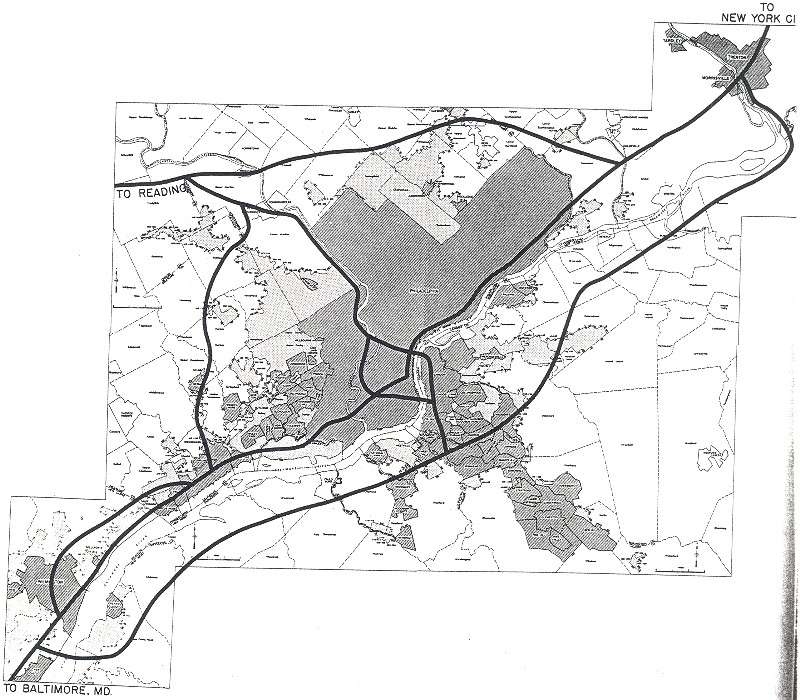
REVIVING I-95: According to the Delaware Valley Regional Planning Commission (DVRPC), the Delaware Expressway carries approximately 80,000 vehicles per day (AADT) through Delaware County and South Philadelphia, and reaches a peak of 150,000 vehicles per day through Center City Philadelphia before carrying approximately 75,000 vehicles per day through Bucks County.
Since the late 1990's, PennDOT has undertaken a multi-year, $6 billion project to rebuild I-95 through Pennsylvania. Much of this work is focused on a 17-mile-long section through Philadelphia, of which bridges make up approximately one-third of the length. The mega-project is comprised of the following components:
PennDOT milled and repaved a short section of I-95 in the area of EXIT 7 (I-476 / Mid-County Expressway / "Blue Route"). The repaving work, part of a $15 million project to repave the southernmost eight miles of I-476 through Delaware County, was completed in mid-2006.
In the area of Philadelphia International Airport (EXIT 12), PennDOT completed a project to build new ramps and bridges to the airport's new departures terminal and existing arrivals terminal. Specifically, the new I-95 "flyover" ramps eliminate the signal and stop intersections previously encountered by motorists who had to exit onto PA 291 to reach the airport. Nearby, PennDOT relocated the Bartram Avenue ramp to southbound I-95, and the northbound collector-distributor (C/D) lanes along the perimeter of the airport. In addition, nine new "mechanically stabilized earth" retaining walls were constructed, and replacement wetlands were created. The $87 million project was completed in June 2002.
PennDOT rehabiliated the 18-span, double-deck Girard Point Bridge. The project included replacement of the bridge's floor beams, structural steel and expansion joints; rehabilitation of bridge decks and walls; replacement of clogged downspouts and clean drainage inlets; repair of isolated areas of corroded steel; and improvements to drainage and lighting. The $7.8 million project was completed in late 2005.
In the city of Philadelphia, PennDOT rebuilt the 26-span Westmoreland Viaduct and the three-span Levick Street Viaduct, both of which were originally built in the mid-to-late 1960's. All bridge reconstruction work included the construction of new walls, support piles, pier footings, piers, beams, bearings and parapets. The concrete roadway deck, approaches and median barriers were replaced through a new technology ("slip-forming) that utilizes a machine to set wet concrete directly in place in the proper shape, eliminating the need for fixed formwork. New signs, lighting, drainage and sound walls rounded out the project. The $120 million project was completed in November 2002, months ahead of schedule.
South of the Westmoreland Viaduct to the Vine Street Expressway (I-676 and US 30), PennDOT is rebuilding approximately two miles of roadway along the mainline I-95, rebuild 27 bridges (including the Richmond Street viaduct that was closed in 2008), construct a new southbound ramp to Delaware Avenue at EXIT 23 (Girard Avenue), and eliminate lane drops by providing a fourth through-travel lane in each direction. Prior to construction, PennDOT is conducting a survey of historic properties within the affected area. The $300 million project, which has been delayed for four years, now is scheduled for 2009 through 2014.
Also within Philadelphia city limits, PennDOT repaired six bridges from EXIT 30 (PA 73 / Cottman Avenue) north to EXIT 32 (Academy Road), a section that was built during the early 1960's. PennDOT also rebuilt the 31-span State Road viaduct; the four-span Pennypack Creek bridge, two bridges over an abandoned quarry north of Pennypack Creek, and two bridges over the Amtrak-SEPTA Northeast Corridor rail line. Engineers also eliminated lane drops through the area by providing a fourth through-travel lane in each direction, and rebuilt 1.2 miles of roadway on the mainline I-95 from Pennypack Creek north to Academy Road. To minimize disruption, PennDOT maintained three (of four) travel lanes in each direction through the I-95 work zone, as well as passage for cyclists under the Pennypack Creek bridge. The $84 million project was completed in mid-2005.
In Bucks County, PennDOT is rebuilding ramps and bridges at EXIT 37 (PA 132 / Street Road) in Bensalem and EXIT 49 (PA 332 / Newtown-Yardley Road) and Morrisville. Construction of $31 million project was completed in late 2006.
Along the length of I-95 through Philadelphia, PennDOT installed an ITS (intelligent transportation system) network of variable message signs and traffic detectors. The five-year project was completed in 2005.
The most ambitious interchange improvement project along the Delaware Expressway lies ahead during the next several years. After decades of inaction, the Pennsylvania Turnpike Commission and PennDOT plan a new interchange that would connect I-95 with the Pennsylvania Turnpike-Delaware River Extension (I-276). The comprehensive project, which is estimated to cost $625 million, would include a new barrier toll plaza on I-276 east of EXIT 351 (US 1) in Bensalem, a new eight-ramp interchange ("single-loop" alternative) where I-95 and I-276 intersect in Bristol Township, and a parallel Delaware River-Turnpike Toll Bridge connecting Bristol to Burlington County, New Jersey.
On January 6, 2004, the U.S. Environmental Protection Agency (EPA) gave the final approval for the project. The current schedule for design and construction is as follows:
2006: Right-of-way acquisition began.
2010: Initial construction (drainage, infrastructure improvements, improvements to surrounding roadways) scheduled to begin.
2011: Construction of direct interchange ramps scheduled to begin.
2014: Interchange scheduled for completion.
Once the direct interchange between I-95 and I-276 - the new EXIT 42 - is completed, the I-95 designation will be shifted from the Delaware Expressway to the Pennsylvania Turnpike-Delaware River Extension as it makes its way into New Jersey. The existing section of I-95 north to Trenton was to be re-designated I-295, but a September 2005 agreement between Pennsylvania and New Jersey established the new designation of I-195 for the orphaned I-95 section. The re-designation awaits approval from the American Association of State Highway and Transportation Officials (AASHTO).
In conjunction with this project, I-95 and I-195 also will be expanded from two to three lanes in each direction for EXIT 40 (PA 413) north to the new interchange. Further widening north of the new interchange to EXIT 49 (PA 332) in Lower Makefield Township may be considered sometime thereafter.
CORRIDOR PLANS THWARTED: In 1995, PennDOT canceled plans for the $2.0 billion I-95 Intermodal Mobility Project, a plan supported by the DVRPC. The project would not only have reconstructed the highway, but also improved access to adjacent rail lines and the Port of Philadelphia. In addition, the project would have added HOV lanes and improved landscaping along the I-95 corridor.
This 2002 photo shows a directional sign leading to the Delaware Expressway in the Tacony (Near Northeast) section of Philadelphia. This sign dates back to the completion of I-95 in the mid-1960's. (Photo by Jim K. Georges.)
To eliminate confusion among motorists traveling on the East Coast, new "local" and "express" branches of I-95 should be created along the Delaware Expressway and the New Jersey Turnpike as follows:
The "local" branch of I-95 would go over the Delaware River-Turnpike Toll Bridge (I-276) to Levittown, Pennsylvania, where a new direct interchange between I-95 and I-276 is being planned. The "local I-95" would continue south along its present route (Delaware Expressway) through Pennsylvania, and along the existing I-495 through Delaware. It would rejoin the "express" I-95 in Newport, Delaware.
The "express" branch of I-95 would continue south of EXIT 6 along the remainder of the New Jersey Turnpike, cross over the Delaware Memorial Bridge and rejoin the "local" I-95 in Newport, Delaware.
(Thanks to phillyroads.com and misc.transport.road contributor Chris Blaney for the recommendation.)
SOURCES: Regional Plan of the Philadelphia Tri-State District, Regional Planning Federation (1932); "Philadelphia Expressway Program," Philadelphia City Planning Commission (1947); "Delaware Expressway: Regional Lifeline," Philadelphia City Planning Commission (1954); "Expressway Sped for Philadelphia," The New York Times (5/12/1955); "Delaware Expressway: Free or Toll," Bureau of Municipal Research (1955); Pennsylvania: Keystone of the Interstate Highway System, Chamber of Commerce of Greater Philadelphia (1958); "Philadelphia's Comprehensive Plan for Expressways," Philadelphia City Planning Commission (1966); "Philadelphia Road Plan Spurs Closer U.S. Ties with Cities," The New York Times (5/28/1967); "Report of the Interdepartmental Task Force on the Delaware Expressway," U.S. Department of Transportation (1967); 1985 Regional Transportation Plan, Delaware Valley Regional Planning Commission (1969); "Expressway Construction Lags as Officials Heed Urban Outcry" by Donald Janson, The New York Times (2/15/1970); Superhighway - Superhoax by Helen Leavitt, Doubleday and Company (1970); "Two Neighborhoods Clash Over Philadelphia Dreams" by Edward Schumacher, The New York Times (8/09/1979); "Interstate 95," Delaware Valley Regional Planning Commission (1979); "I-95 Corridor in the Tri-State Region," Tri-State Regional Planning Commission (1979); "Schuylkill Carries the Load of Many Roads Left Unbuilt" by Paul Nussbaum, The Philadelphia Inquirer (8/19/1984); "For Users of I-95, No More Missing Link" by Susan Caba, The Philadelphia Inquirer (12/15/1985); "I-95 Completion Program for Philadelphia's Central Waterfront," Pennsylvania Department of Transportation (1985); "Let the Driver Beware: I-95 May Get the Next Big Fix," The Philadelphia Inquirer (1/12/1990); "$2 Billion Plan for I-95 Cut Back Sharply" by Larry Fish, The Bergen Record (12/03/1995); "Months of Repairs Seen After Highway Fire," The New York Times (5/25/1998); "High Steel Helps Repair Damage to I-95 Bridge" by Stephen Kopfinger, The Lancaster Sunday News (7/05/1998); "Neighborhoods Hope Ramps Lead to Peace" by Maria Panaritis, The Philadelphia Inquirer (8/30/1998); "Pennsylvania Turnpike / I-95 Interchange Project," KCI Technologies (October 1999); "Weighing the Impact of I-95, Turnpike Interchange" by Lewis Kamb, The Philadelphia Inquirer (12/11/1999); "I-95 News Conference Fact Sheet," Pennsylvania Department of Transportation (2001); "Pennsylvania Turnpike / Interstate 95 Interchange Project: Draft Environmental Impact and Section 4(f) Statement," Federal Highway Administration, Pennsylvania Department of Transportation and Pennsylvania Turnpike Commission (2001); "The Subways, Railways and Stations of Philly" by Harry Kyriakodis (2001); "I-95's Stranglehold on Riverfront" by Inga Saffron, The Philadelphia Inquirer (11/17/2002); "Prepare for the Next Wave of I-95 Traffic Headaches in the Northeast" by Jere Downs, The Philadelphia Inquirer (11/20/2002); "Reviving Interstate 95," Pennsylvania Department of Transportation (2002); "$640 Million Plan Linking I-95 with PA Turnpike OK'd" by Jere Downs, The Philadelphia Inquirer (1/07/2004); "Repairs Scheduled for I-476 and I-95," WPVI-TV (10/21/2004); "Construction Starts on Bridge in 2008" by Chris English, Bucks County Courier-Times (2/07/2005); "I-95: Where Do We Go Now?" by Matt Blanchard, Plan Philly / University of Pennsylvania School of Design (2007); "I-95 Shut Down for Emergency Repairs" by Sam Wood Michael Matza, and Edward Colimore, The Philadelphia Inquirer (3/18/2008); "I-95 To Get More Than Today's Quick Fix" by Peter Mucha and Joseph Gambardello, The Philadelphia Inquirer (3/19/2008); "Pennsylvania Turnpike / Interstate 95 Interchange Project," Pennsylvania Turnpike Commission (2008); Delaware River Joint Toll Bridge Commission; Chris Blaney; Peggy Darlington; Ralph Herman; Jeff Kitsko; Scott Kozel; Raymond C. Martin; Dan Moraseski; Len Pundt; Alex Nitzman; Sandy Smith; Jeff Taylor; Rush Wickes.
I-95, I-276, and I-195 shields by Ralph Herman. Pennsylvania Turnpike shield by James Lin. Lightposts by Millerbernd Manufacturing Company. HOV lane sign by C.C. Slater.


